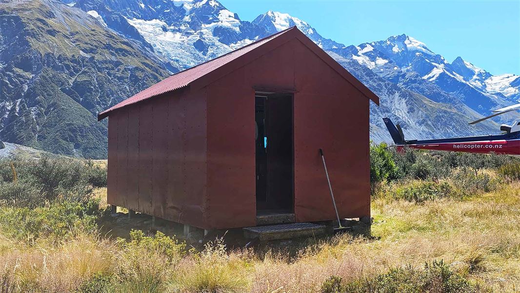
Liebig Hut
Standard hutAoraki/Mount Cook National Park, CanterburyDOC data as at 20 September 2026
About this place
This is a standard six-bunk hut in the Aoraki/Mount Cook area.
Know before you go
Stay safe when crossing rivers and streams
If you plan to cross unbridged rivers or side streams, know how to cross safely and be prepared for if you cannot cross. Do not cross if the river or stream is flooded, you cannot find safe entry and exit points or are unsure it’s safe. Turn back or wait for the river to drop. If in doubt, stay out. How to cross rivers safely NIWA river flow forecasts: View a video of national followed by regional river flows
Source: DOC Te Papa Atawhai.
Fees and bookings
Before you go, buy Hut Tickets for each night's stay. Put these in the honesty box at the hut. Or buy a Backcountry Hut Pass that gives unlimited use at most Standard and Serviced huts for a 12 month period. Retailers that sell hut tickets and passes
Source: DOC Te Papa Atawhai.
Getting there
- Topo map
- Topo50 sheet BX16
Source: DOC Te Papa Atawhai.
Contact
Aoraki/Mount Cook National Park Visitor Centre
1 Larch Grove, Aoraki/Mount Cook 7999
Regional DOC service centre.
Nearby stops
Onslow Hut (Steffan Memorial Hut)
Basic/bivvies • 4 bunks • Canterbury • 2.1 km
Mattresses • Lighting • Toilets - non-flush
Lady Emily Hut
Canterbury • 7.3 km
Memorial Hut
8 bunks • Canterbury • 8.1 km
Beetham Hut
Basic/bivvies • 4 bunks • Canterbury • 8.5 km
Mattresses • Toilets - non-flush • Water from tap - not treated
The Bad Decision Hut
Canterbury • 8.5 km
All details
- Facilities
- MattressesToilets - non-flushWater from streamWater supply
- Bookable
- No
- Category
- Standard
- Location
- Aoraki/Mount Cook National Park
- Fireplace
- No
- Mattress
- Yes
- Capacity
- 6
- Toilets
- Yes
- Drinking water
- No
- Reservations
- No
- Fee
- Yes
- Website
- This place on doc.govt.nz
- Source data
- View source data
Map
Map data © OpenStreetMap contributors.43.62914° S, 170.31014° E
Something not right?
Closed, moved, wrong facts, or you know something we do not. Change only what you know is wrong or missing; a person checks it before it goes live. Or email us about this place.
Sources
- OpenStreetMap Huts · ODbL (Open Database License)Contains information from OpenStreetMap, made available under the ODbL.
- DOC Huts (API) · CC BY 4.0Crown Copyright: Department of Conservation Te Papa Atawhai. Data sourced from the DOC Developer Portal (api.doc.govt.nz).
- DOC Huts · CC BY 4.0Data sourced from the Department of Conservation (DOC), New Zealand.