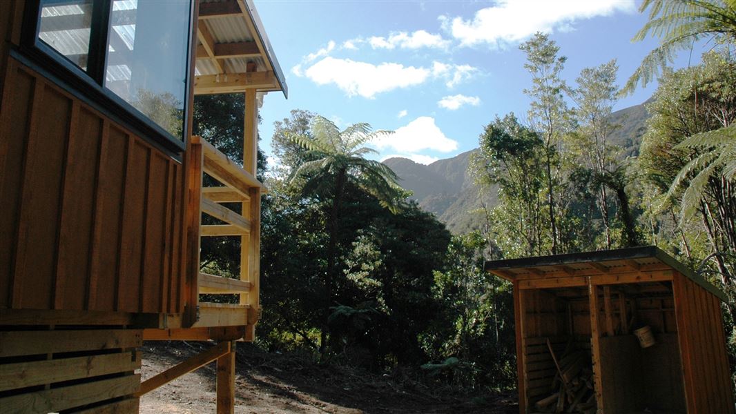
Papatahi Hut
Serviced hutCatchpool Valley & Ōrongorongo Valley, Wellington/KapitiDOC data as at 20 September 2026
Current advisories
Ungulate control for parts of Remutaka Forest Park
03 August 2026
Ungulate (goats, deer, pigs) control work will take place from 10 August 2026 to 30 June 2027. The operation will include both aerial shooting and ground hunting with indicator dogs, thermal drone assistance as well as aerial surveillance and trail cameras for monitoring. The operation area is shown on the map in the solid pink and solid yellow buffer zones. Remutaka ungulate operation area map (PDF, 140K) First published on 22 January 2026. Last reviewed on 4 August 2026.
Ōrongorongo Track reroute
11 June 2026
A section of the Ōrongorongo Track at Jacob’s Ladder has been rerouted due to the risk of an imminent collapse. The slip cannot be seen from the track. The reroute is well signposted. Turn back if you find yourself on a section of rough, uneven track with deep cracks. The rerouted track is a temporary tramping track with some large, unformed steps. Jacob’s Ladder is the area where the track descends steeply down to the Ōrongorongo River Valley. This is about five minutes before the curved bridge when travelling from the Catchpool car park end. This is a long term alert. First published on 20 March 2023. Last reviewed on 12 June 2026.
Source: DOC Te Papa Atawhai alerts.
About this place
This is a serviced 10-bunk hut in the Wellington region. The hut is locked and must be booked in advance to gain access.
Fees and bookings
1 October - 30 April
1 December - 29 February
Bookings are open for stays up to 30 June 2027. If no availability shows online for your dates, the lodge is fully booked. No spaces are kept for visitors arriving without a booking. Phone and in‑person bookings made at a visitor centre incur a $10 service fee. Same‑day bookings are available online until 8 pm if spaces remain. Book Papatahi Hut online . The Ōrongorongo River is not safe to cross in all conditions. If the river is flooded, rising or there is rain forecast, do not attempt to cross. You will be eligible for a refund if you had to cancel your stay due to river safety. Contact Nelson visitor services: phone +64 3 546 9339 or email nelsonvc@doc.govt.nz .
Source: DOC Te Papa Atawhai.
Getting there
- Topo map
- Topo50 sheet BQ32
- Grid reference
- E1769108, N5423351
Source: DOC Te Papa Atawhai.
On these tracks
Source: DOC Te Papa Atawhai.
Contact
Wellington/Kapiti information
Regional DOC service centre.
Nearby stops
All details
- Facilities
- CookingHeatingMattressesToilets - non-flushWater from tap - not treatedboil before useWater supply
- Bookable
- Yes
- Category
- Serviced
- Location
- Catchpool Valley & Ōrongorongo Valley
- Fireplace
- Yes
- Mattress
- Yes
- Capacity
- 10
- Toilets
- Yes
- Drinking water
- untreated
- Reservations
- required
- Fee
- Yes
- Website
- This place on doc.govt.nz
- Source data
- View source data
Map and tracks
Track lines: DOC Te Papa Atawhai. Map data © OpenStreetMap contributors.41.32383° S, 175.01981° E
Something not right?
Closed, moved, wrong facts, or you know something we do not. Change only what you know is wrong or missing; a person checks it before it goes live. Or email us about this place.
Sources
- DOC Huts (API) · CC BY 4.0Crown Copyright: Department of Conservation Te Papa Atawhai. Data sourced from the DOC Developer Portal (api.doc.govt.nz).
- DOC Huts · CC BY 4.0Data sourced from the Department of Conservation (DOC), New Zealand.
- OpenStreetMap Huts · ODbL (Open Database License)Contains information from OpenStreetMap, made available under the ODbL.