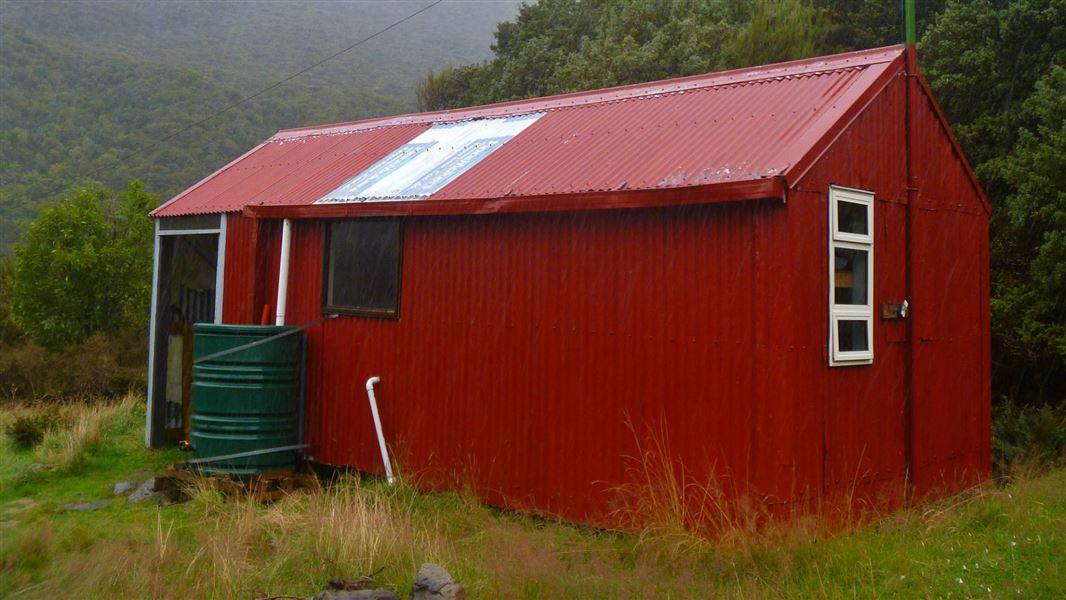
Park Morpeth Hut
Serviced Alpine hutArthur's Pass National Park, CanterburyDOC data as at 20 September 2026
Current advisories
Predator control for Wilberforce Mathias
31 August 2026
We plan to distribute non-toxic cereal bait pellets by helicopter on 14 September 2026 depending on the weather. The Rangitata-Rakaia headwaters conservation Area, Central southern Alps/Ka Tiritiri o to Moana Wilberforce Conservation Area, Rakaia Forest Conservation Area and Craigeburn Forest Park will remain open. You are advised not to walk the Three Passes Route on the day/s of the operation. For more information see the Operation factsheet (PDF, 1,200K). See the Pesticide Summary Map for the operation area. DOC will distribute toxic bait containing 1080 within a month of applying the non-toxic bait. This operation is part of DOC's National Predator Control Programme to protect native species. First published on 1 September 2026.
Source: DOC Te Papa Atawhai alerts.
About this place
This is a standard six-bunk hut in the North Canterbury and Arthur's Pass area.
Know before you go
The NZ Mountain Radio Service has closed down
The NZ Mountain Radio Service has closed and the mountain radio at this hut is no longer monitored. Visitors should carry a Personal Locator Beacon (PLB) as a method of emergency contact. Prepare for your trip with an extended weather forecast before heading into the backcountry.
Source: DOC Te Papa Atawhai.
Getting there
- Topo map
- Topo50 sheet BV20
Source: DOC Te Papa Atawhai.
Contact
Arthur's Pass National Park Visitor Centre
104 West Coast Road, Arthur's Pass 7654
Regional DOC service centre.
Nearby stops
All details
- Facilities
- MattressesLightingToilets - non-flushWater from tap - not treatedboil before useWater supply
- Bookable
- No
- Category
- Serviced Alpine
- Location
- Arthur's Pass National Park
- Fireplace
- No
- Mattress
- Yes
- Capacity
- 6
- Toilets
- Yes
- Drinking water
- untreated
- Reservations
- No
- Website
- This place on doc.govt.nz
- Source data
- View source data
Map and tracks
Track lines: DOC Te Papa Atawhai. Map data © OpenStreetMap contributors.42.97177° S, 171.34191° E
Something not right?
Closed, moved, wrong facts, or you know something we do not. Change only what you know is wrong or missing; a person checks it before it goes live. Or email us about this place.
Sources
- OpenStreetMap Huts · ODbL (Open Database License)Contains information from OpenStreetMap, made available under the ODbL.
- DOC Huts · CC BY 4.0Data sourced from the Department of Conservation (DOC), New Zealand.
- DOC Huts (API) · CC BY 4.0Crown Copyright: Department of Conservation Te Papa Atawhai. Data sourced from the DOC Developer Portal (api.doc.govt.nz).