Young Fork
Backcountry campsiteLocated in Mount Aspiring National Park, OtagoDOC data as at 20 September 2026
Current advisories
Predator control for Mt Aspiring National Park
01 June 2026
A predator control operation using toxic bait containing 1080 was completed on 2 March 2026. The operation area includes Mt Aspiring National Park. It is open to the public with warning signs in place at key entrances. There may be toxic carcasses and bait (green coloured pellets) in the area. Do not touch the bait or animal carcasses. Water supply at the huts will be unaffected as tanks will be disconnected from the guttering, but as usual we recommend treating water before drinking. This operation is part of DOC's National Predator Control Programme to protect native species. First published on 16 September 2025. Last reviewed on 2 June 2026.
Source: DOC Te Papa Atawhai alerts.
About this place
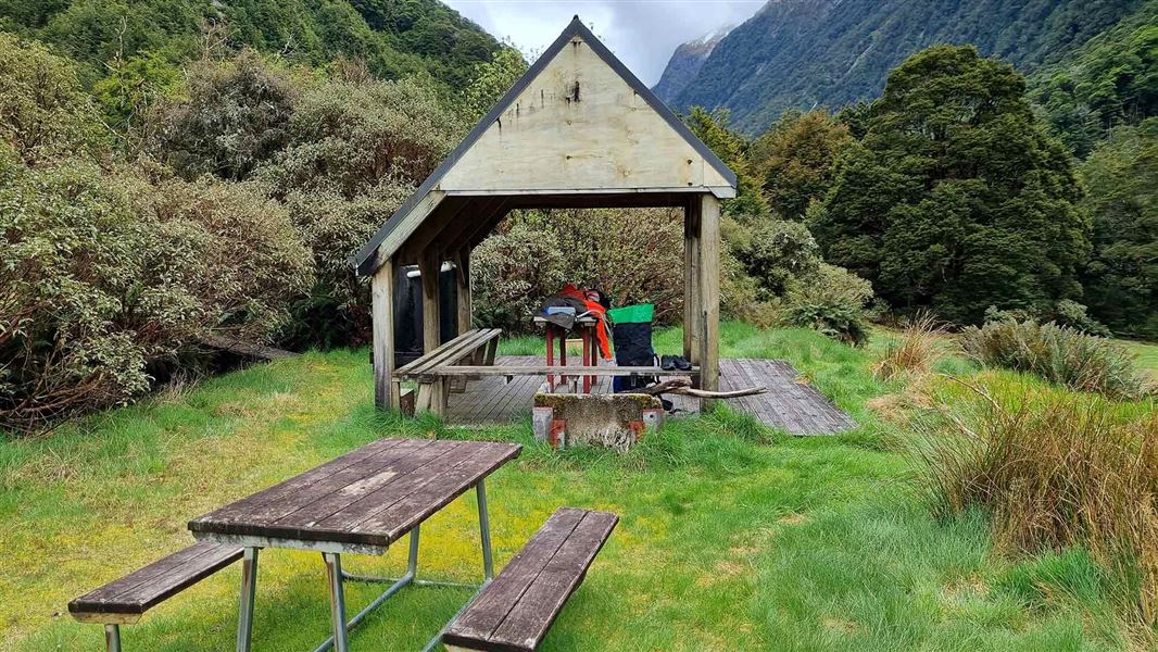
This is a walk-in, backcountry campsite in the Wanaka/Makarora area. Camp in the Young Valley as part of the Gillespie Pass Circuit.
Fees and bookings
First-come, first-serve
Source: DOC Te Papa Atawhai.
Contact
Wānaka Tititea/Mount Aspiring National Park
Regional DOC service centre.
Nearby stops
All details
- Facilities
- ['Non-powered/tent sites''Shelter for cooking''Water from stream''Water from tap - not treatedboil before use''Toilets - non-flush''Toilets''Water supply']
- Activities
- ['Walking and tramping']
- Access
- ['Foot']
- Setting
- ['Forest''Rivers and lakes']
- Bookable
- No
- Category
- Backcountry
- Dogs
- No dogs. Other pets on conservation land rules.
- Location
- Located in Mount Aspiring National Park
- Source data
- View source data
Map and tracks
Track lines: DOC Te Papa Atawhai. Map data © OpenStreetMap contributors.44.17165° S, 169.14308° E
Something not right?
Closed, moved, wrong facts, or you know something we do not. Change only what you know is wrong or missing; a person checks it before it goes live. Or email us about this place.
Sources
- OpenStreetMap Campsites · ODbL (Open Database License)Contains information from OpenStreetMap, made available under the ODbL.
- DOC Campsites (API) · CC BY 4.0Crown Copyright: Department of Conservation Te Papa Atawhai. Data sourced from the DOC Developer Portal (api.doc.govt.nz).